Maps
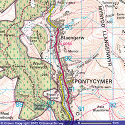
Map of the Garw Valley
The Garw Valley
This part of the Garw Valley once had 6 working coal mines and innumerable coal levels (drift mines). The collieries were:
Lluest – working in 1880 and closed in 1902, Ffaldau – sunk in 1877 and closed in 1985, Darren – sunk in 1880s and closed in 1924, Glenafon – sunk in 1903 and closed in 1959, International – sunk in 1890-1893 and closed in 1967, Garw – sunk in 1883 and closed in 1985.
Reclamation of the area began in 1989, the slag heaps were removed, two small lakes now lie where the Garw Colliery once stood and a cycle path has now replaced the railway between Pontycymer and Blaengarw.
See what this area looked like in 1884 click here.